Last updated: October 8, 2025 at 11:46 am
Granite Chief Wilderness Trail Reroute Project Receives $800,000 Award Through Great American Outdoors Act.
The Western States Endurance Run (WSER) is pleased to announce that the U.S. Forest Service – American River Ranger District (USFS) has secured $800,000 in funding for the Granite Chief Wilderness Trail Reroute Project (Project) through the Great American Outdoors Act (GAOA). The USFS, the Western States Endurance Run Foundation (organizers of the WSER), and the Western States Trail Foundation (organizers of the Tevis Cup Ride), worked together over several years to develop and gain approval of a plan for non-motorized alternative trail access through Granite Chief Wilderness (the Wilderness). Planning activities culminated in a 2019 Decision Memo, issued by the USFS, that formalized the decision to proceed with the Project.
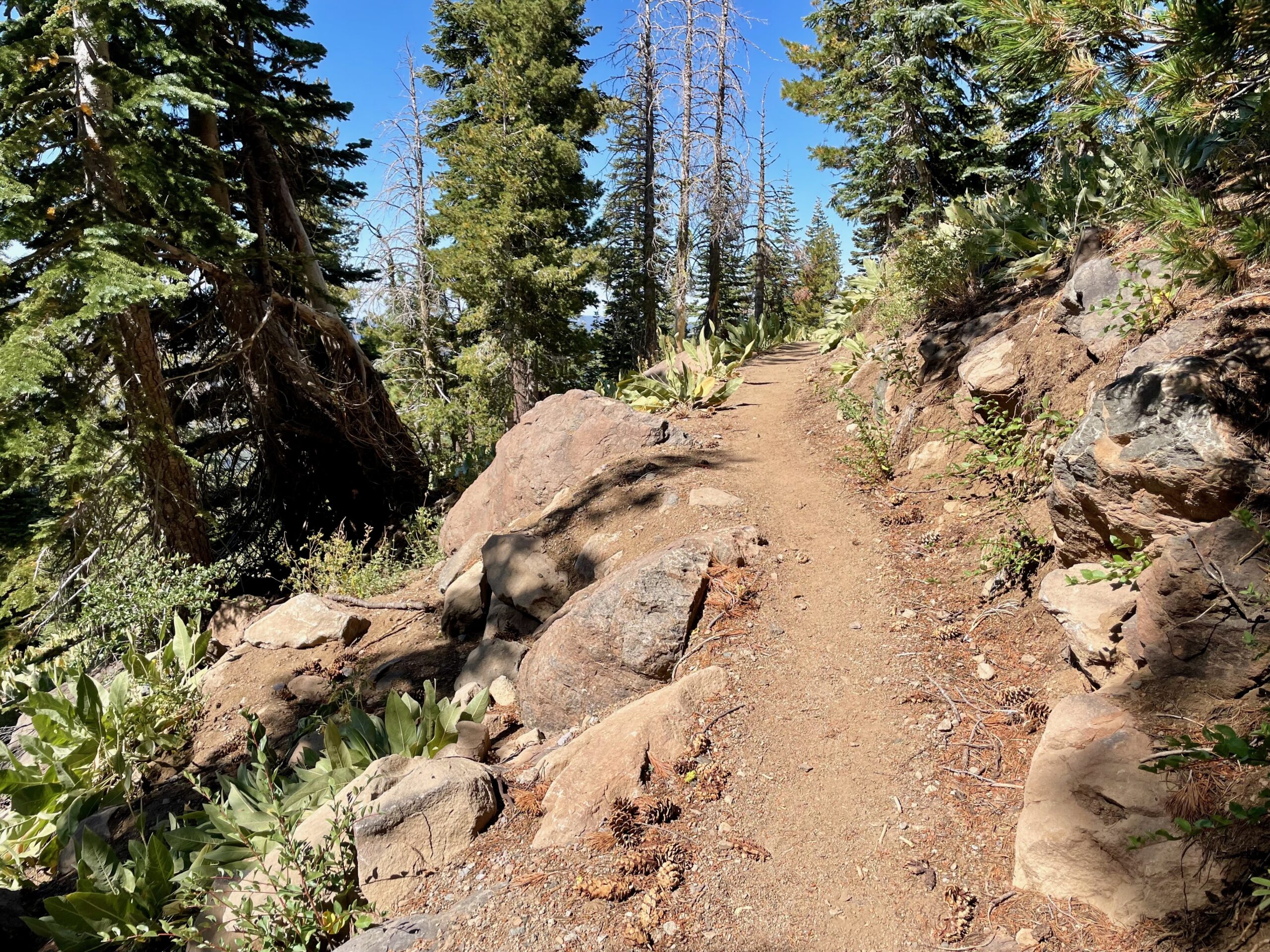
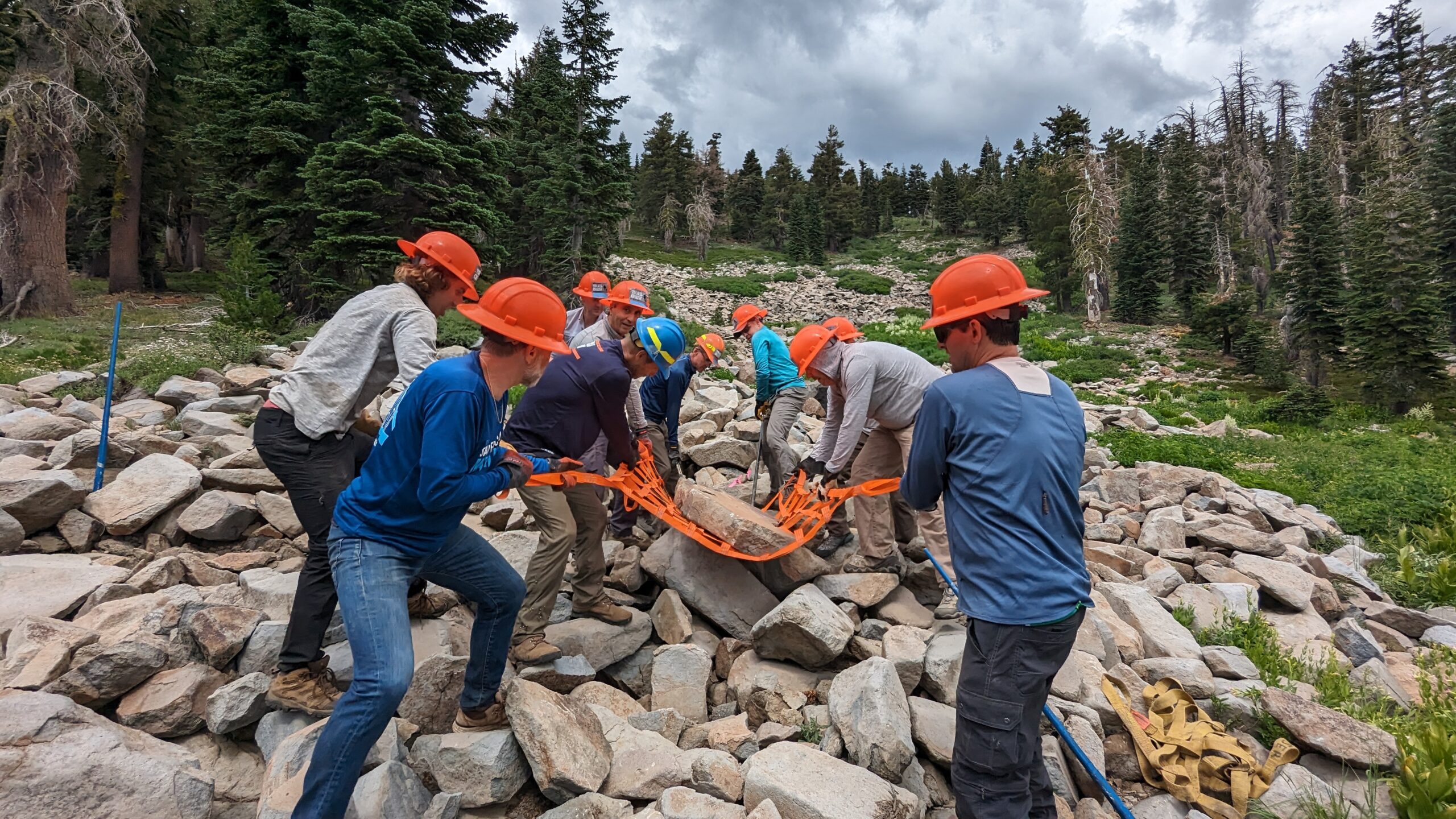
The trail through the Wilderness that WSER uses on race day stretches from approximately miles 4 through 10.5 of the WSER course. Although the western portion of the trail through the newly expanded Wilderness has been recently rehabilitated and meets current USFS trail building specifications, other portions of the existing trail through the Wilderness were developed long before modern trail building criteria and techniques were defined, while other portions of the trail were created by citizens (social trails) that are not within the formally recognized trail network. The existing trail alignment is problematic with regard to both user safety and resource damage. In places the trail is overly steep with grades up to 30%, and over time have become heavily rutted and channelized, contributing to excessive erosion in sensitive sub-alpine riparian terrain. For decades volunteers from WSER and the Tevis Cup Ride have partnered with the USFS to maintain the trail through the Wilderness, but because of its design, or lack of design, it has required an increasing level of commitment.
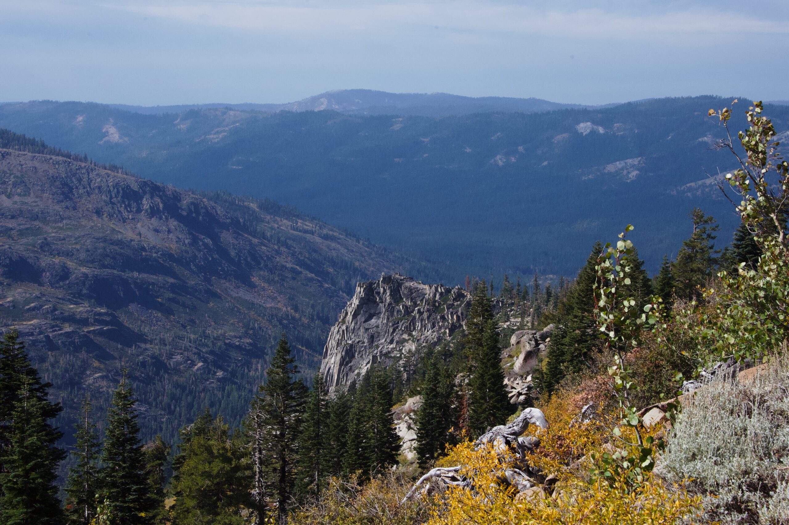
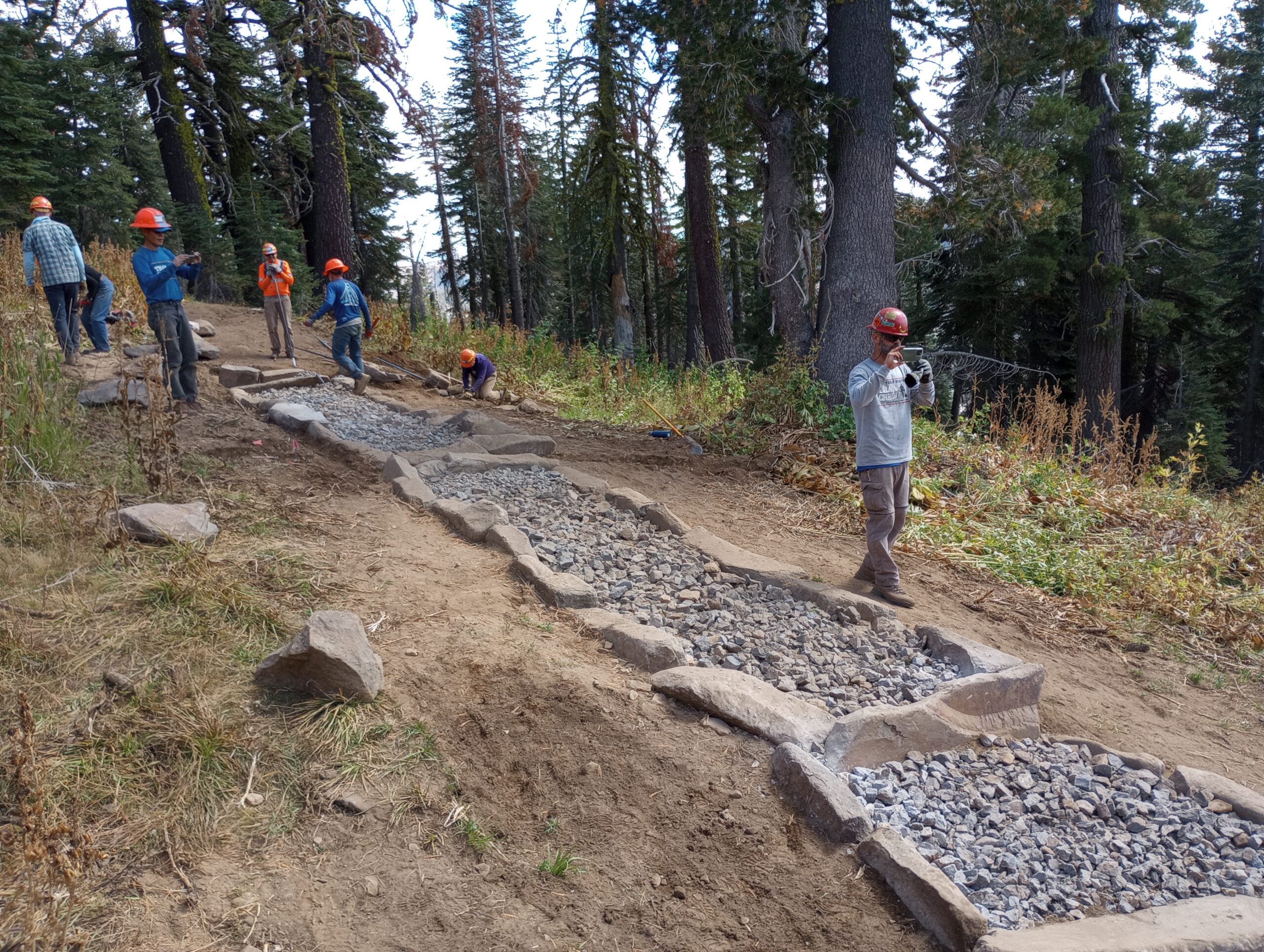
The Project is designed to close sections of the existing trail that have unsustainable grades that traverse a series of hillside springs (bogs) and replace these trail sections with sustainable trail segments that will be farther upslope and out of the densely vegetated area where the springs discharge. The Project has been divided into nine trail segments (see figure), and will result in 5.7 miles of new trail, along the ridge connecting Granite Chief, Needle and Lyon Peaks. New trail segments will access alpine terrain that has not previously been accessible, which will afford stunning views to the south, east, and west. When completed the new trail system will allow recreational users the opportunity to walk, run, or ride shorter loop routes from both the east and northwest side of the Wilderness. New trail segments will be designed using Best Management Practices to minimize erosion and be safer for all users. Unsustainable sections of the existing trail will be closed and vegetation in the affected area restored.
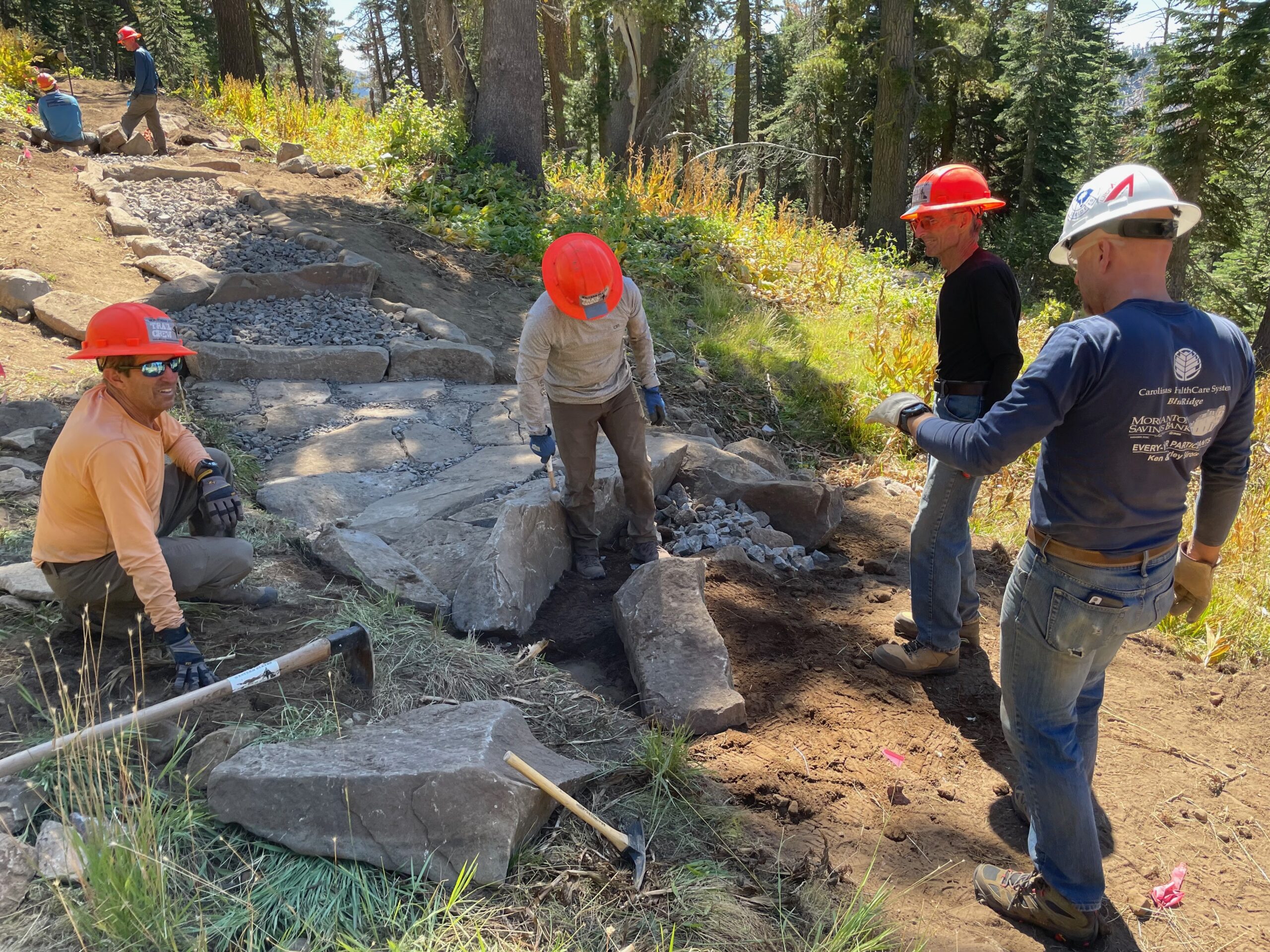
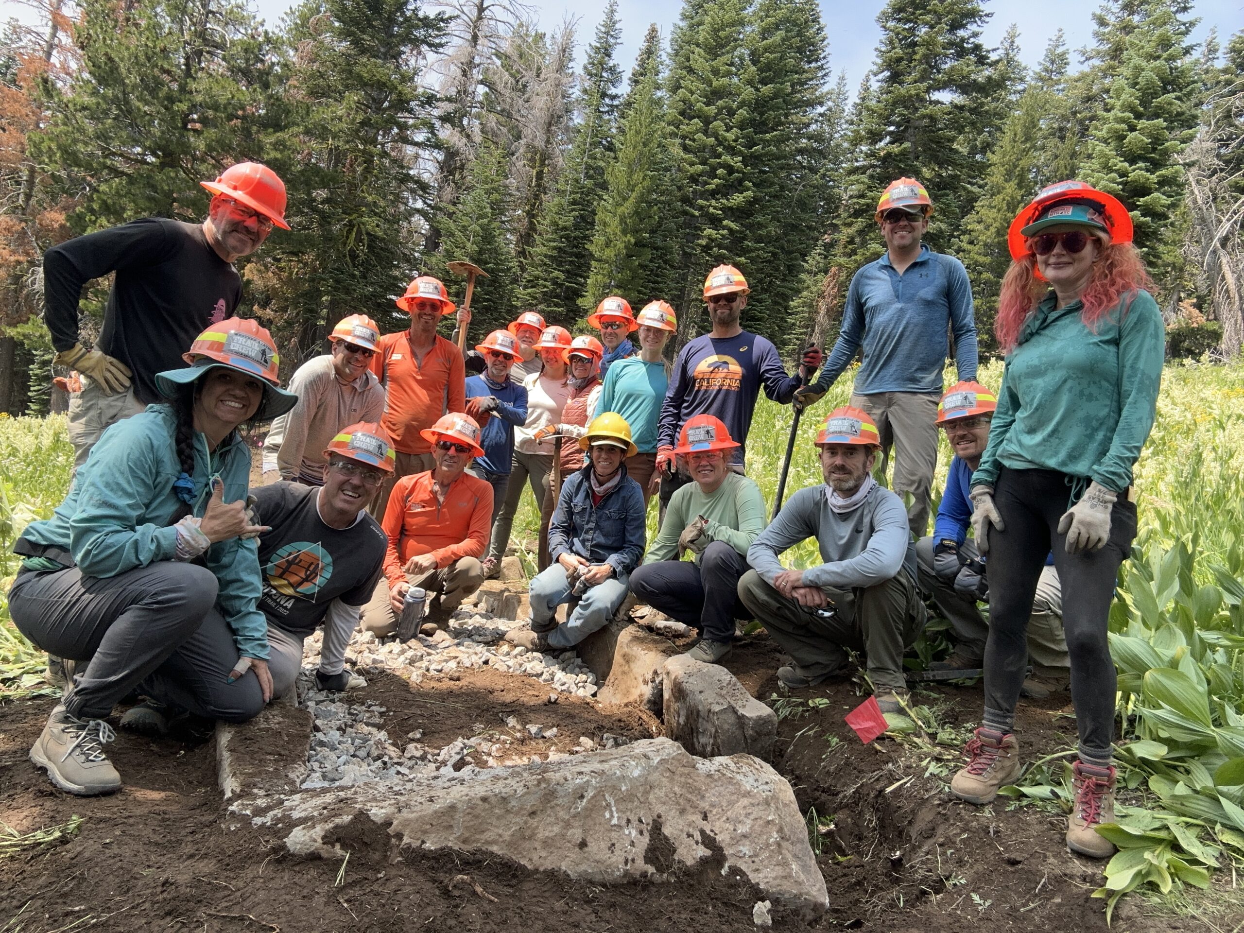
![]() On a typical year the project area is covered by snow from October to June, and therefore field work can only be performed during summer months. The Project has been scheduled for the summers of 2023, 2024, and 2025. A 20-person professional trail crew will live in the Wilderness and work 5 days each week, for a total of 14 weeks. On weekends volunteer trail crews will perform work commensurate with their skill level. For the summers of 2023 and 2024 access will be arranged with the Palisades Tahoe Resort, and trail workers will use Palisades Tahoe maintenance roads to bring supplies and personnel into the Wilderness from the east. For the summer of 2025 access will be from the northwest edge of the Wilderness using Forest Service Road 51.
On a typical year the project area is covered by snow from October to June, and therefore field work can only be performed during summer months. The Project has been scheduled for the summers of 2023, 2024, and 2025. A 20-person professional trail crew will live in the Wilderness and work 5 days each week, for a total of 14 weeks. On weekends volunteer trail crews will perform work commensurate with their skill level. For the summers of 2023 and 2024 access will be arranged with the Palisades Tahoe Resort, and trail workers will use Palisades Tahoe maintenance roads to bring supplies and personnel into the Wilderness from the east. For the summer of 2025 access will be from the northwest edge of the Wilderness using Forest Service Road 51.

Craig Thornley, Race Director for WSER, states: “I have been very excited about this new trail since I first walked it a few years ago. It will not only provide a more environmentally sensitive and sustainable way to traverse the Wilderness and substantially improve the views, but because the new route across the Wilderness will be shorter it will allow us to make other changes farther down our event route to incorporate more single-track and sustainable trail sections.”

Chuck Stalley, the Ride Director for the Tevis Cup also supports the project, as “it will provide safer passage for our horses and their riders and require less annual maintenance.”
Matt Brownlee, the USFS District Trails Manager, is fully committed to the Project “This exciting new trail realignment project will require three years of hard work but will provide years of public enjoyment while at the same time protecting sensitive resources in federally protected wilderness. This project was originally identified in 1993 due to accelerated erosion and lack of trail design parameters but didn’t gain traction until 2016 when myself/WSER/WSTF representatives began initial ground-truthing. Obvious terrain and construction hurdles will make this a logistically challenging project but will benefit the American public for years to come. A mentor of mine used to say “just go out there and make it better”, I truly feel that’s what we are going to accomplish with this legacy project and I welcome any and all who would like to be part of it.”

The USFS has estimated the Project will cost $1,350,000. GAOA funding will cover $800,000 of the cost and WSER has secured funding for its share of the remaining $550,000 in cost.

Discover more from WSER
Subscribe to get the latest posts sent to your email.