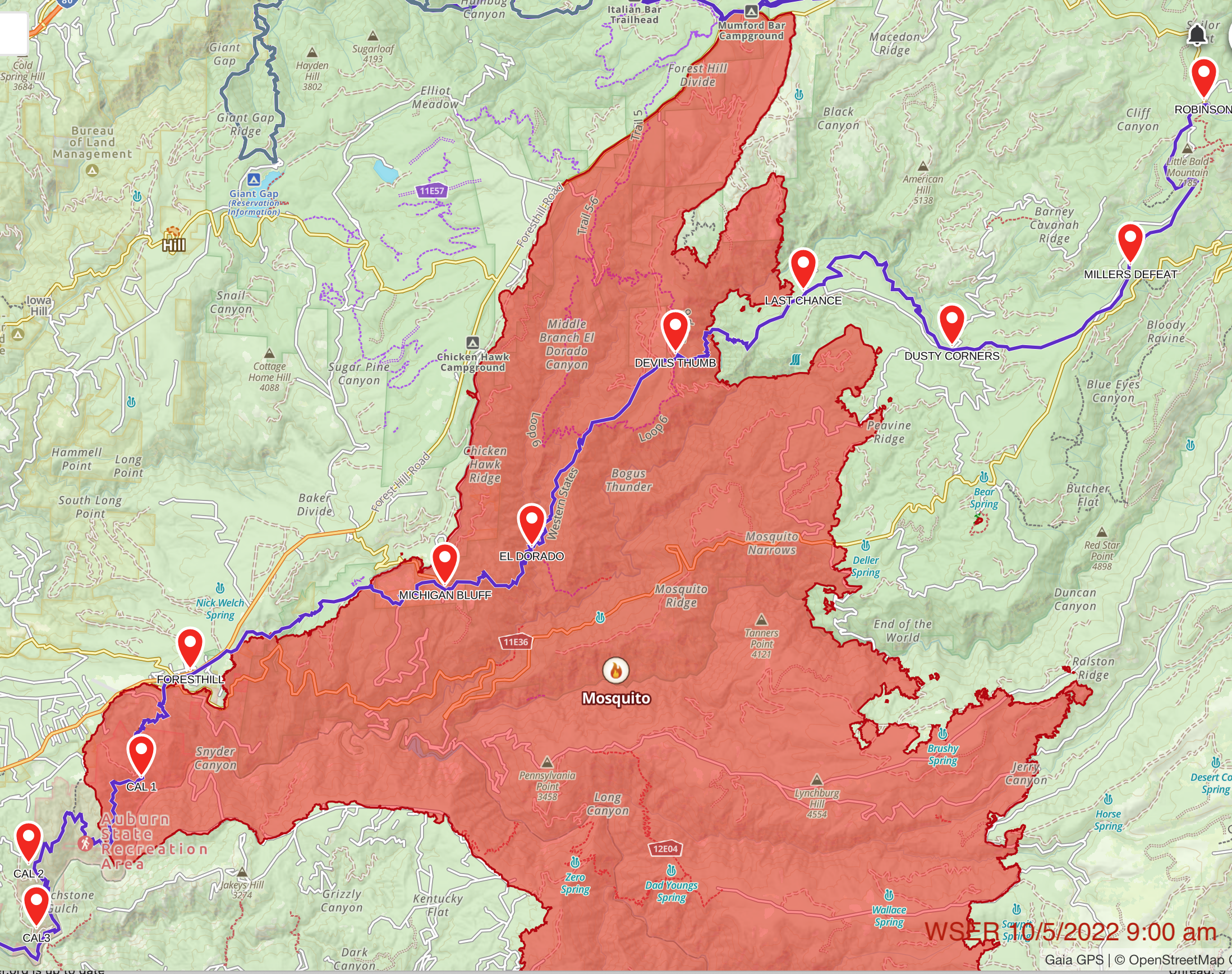
On September 6, 2022, the Mosquito fire started at Oxbow Dam. The fire quickly spread uphill towards Michigan Bluff and Foresthill. As of today the fire is 95% contained and has burned over 76,000 acres. 78 structures were destroyed, many in the Michigan Bluff area.
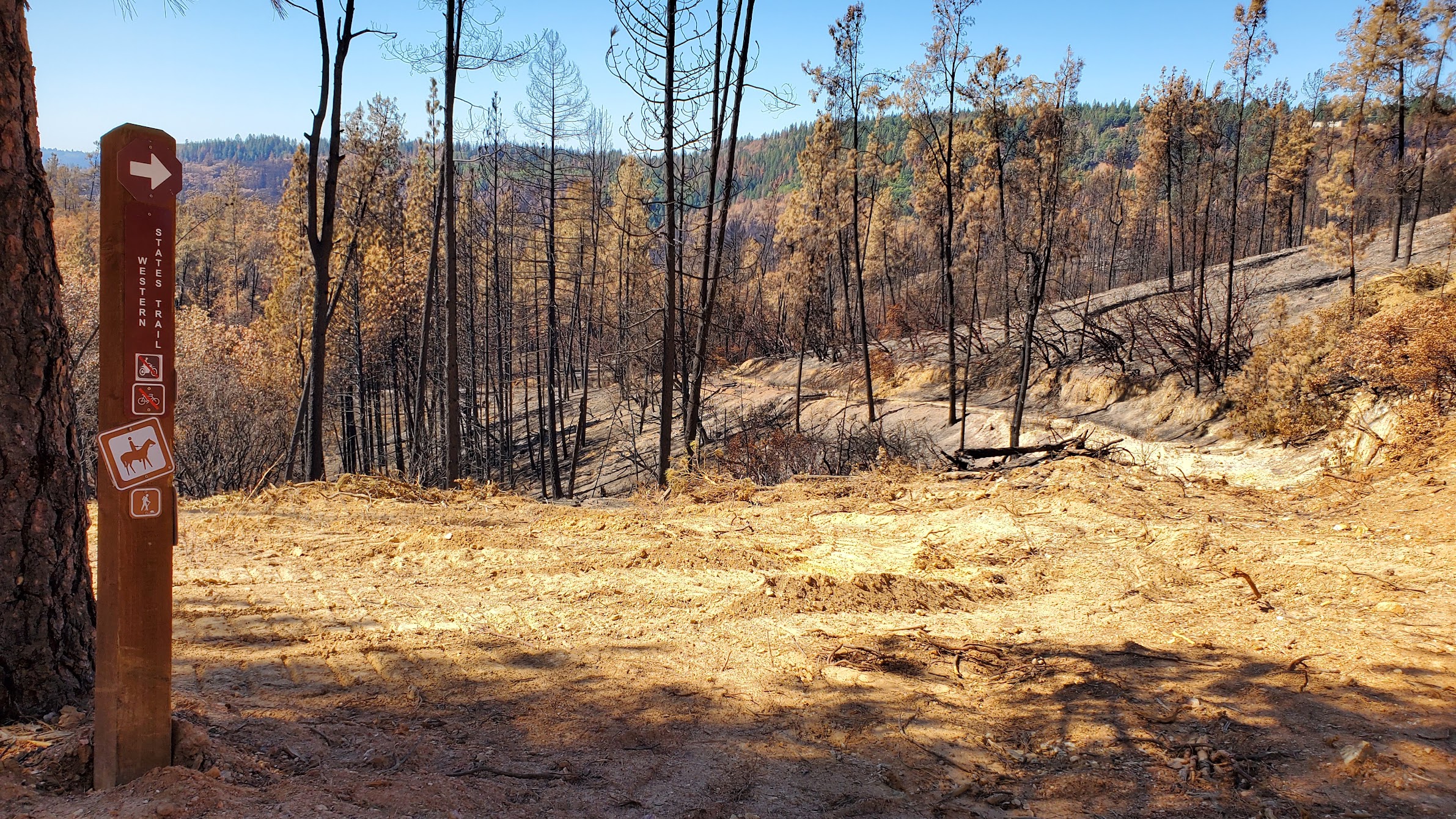
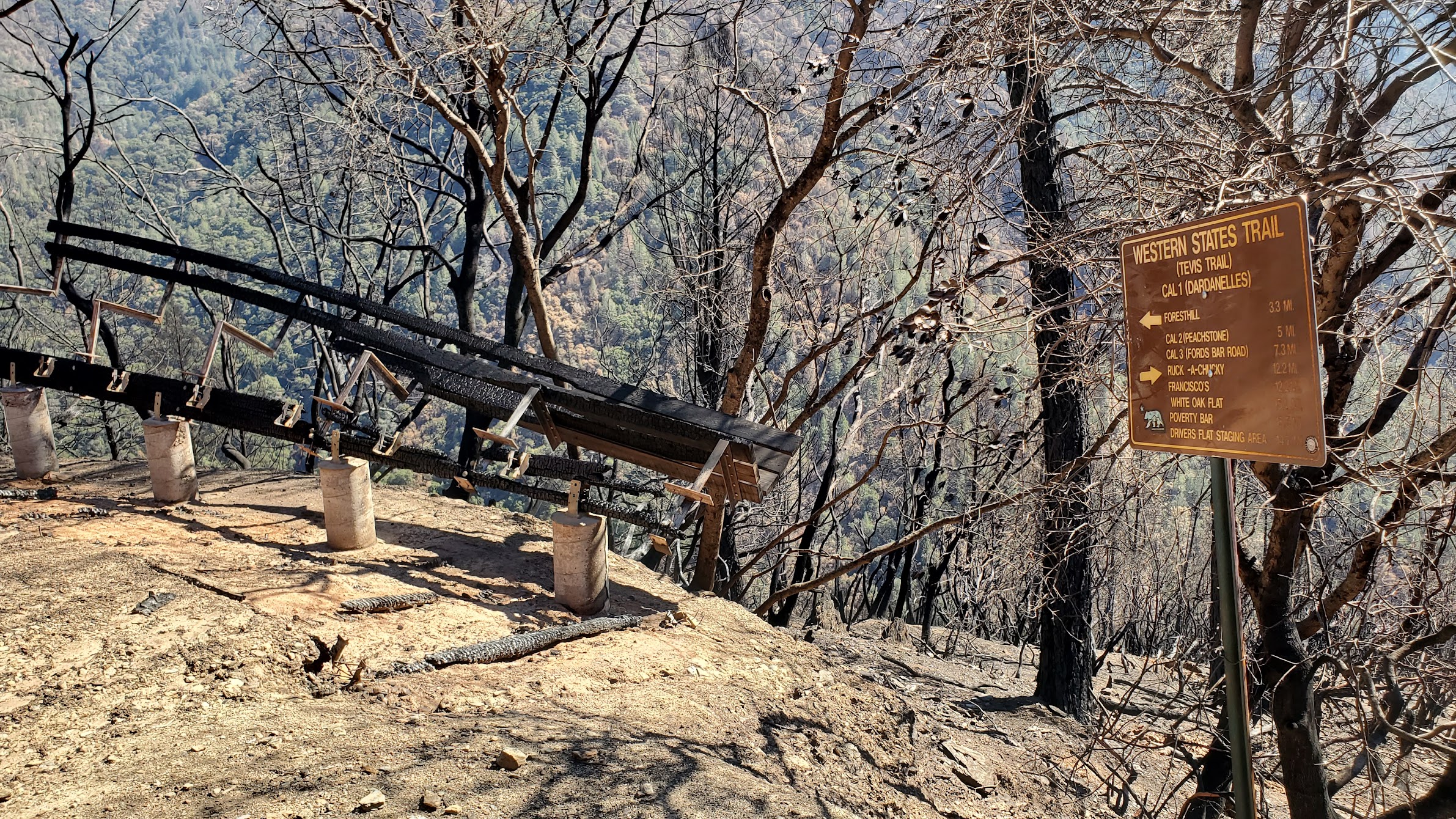
Regarding the Western States Trail the easternmost extent affected by the fire is near Swinging Bridge (mile ~46 on the course) and the westernmost extent affected is the Patent Road Fire Break (5.7 miles west of Foresthill, or mile ~68 on course). While this is a total of about 22 miles of trail, the trail through Volcano Canyon and Foresthill was not inside the burn perimeter, and therefore only about 16 miles of the trail were directly impacted by the fire.
With respect to post-fire restoration we will be working with three land agencies/owners: US Forest Service (USFS) from Swinging Bridge to Bath Rd, a private land owner from Foresthill to just before Cal-1, and Auburn State Recreation Area (ASRA) for the westernmost 3 miles to the Patent Road Fire Break.
Good news:
- The Last Chance Townsite and aid station location was not burned
- Pacific Slab Bridge was not affected
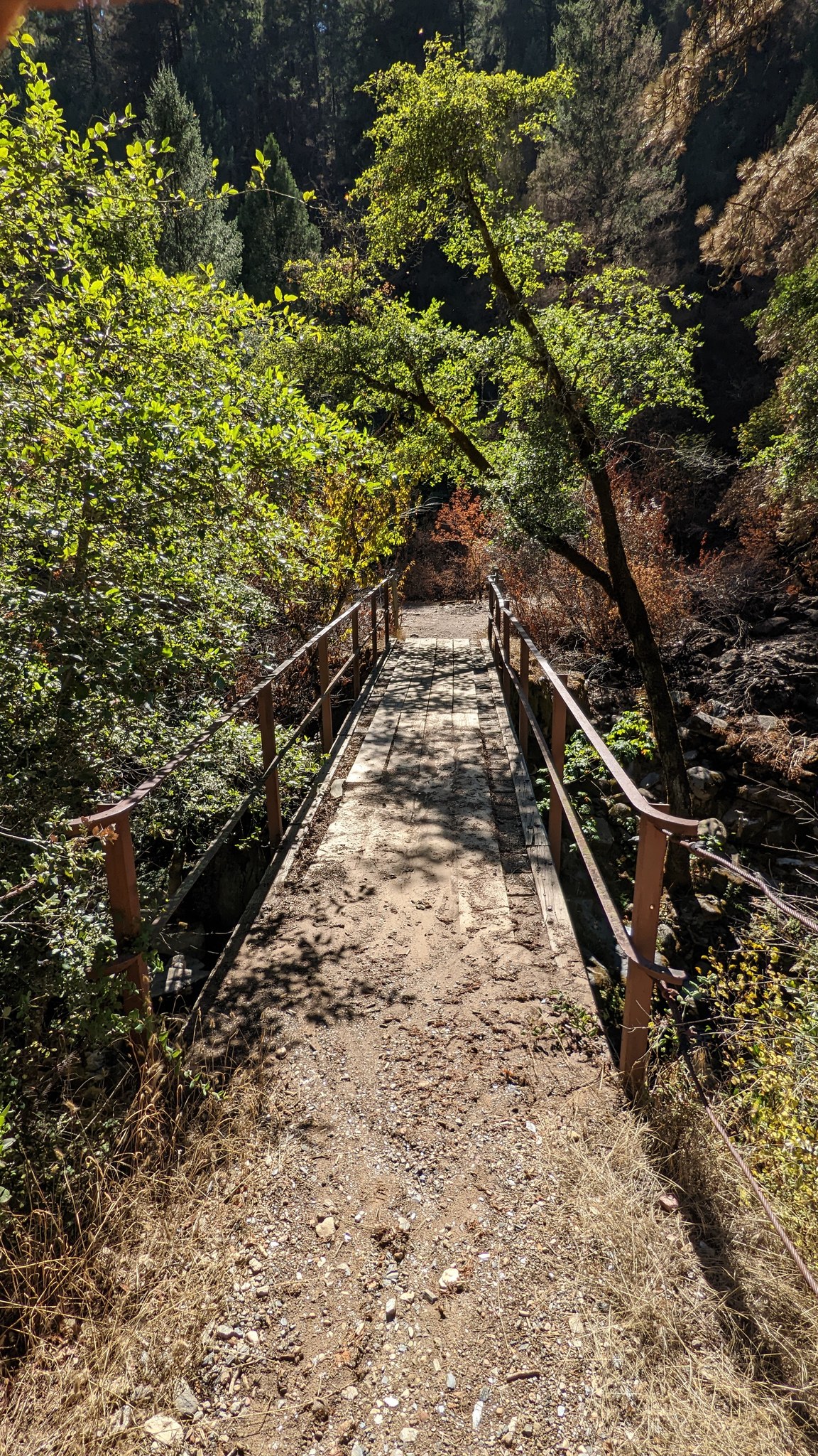
- The Swinging Bridge was unburned
- The Deadwood Pump is fully operational
- The El Dorado Creek bridge was unburned
- Michigan Bluff homes where the aid station is survived
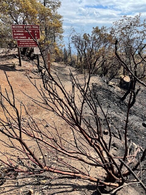
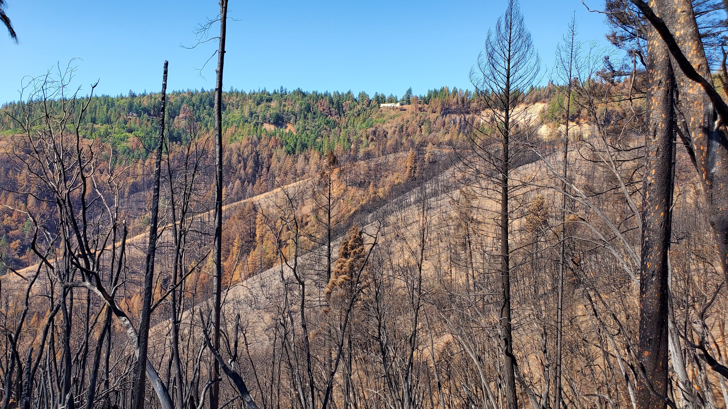
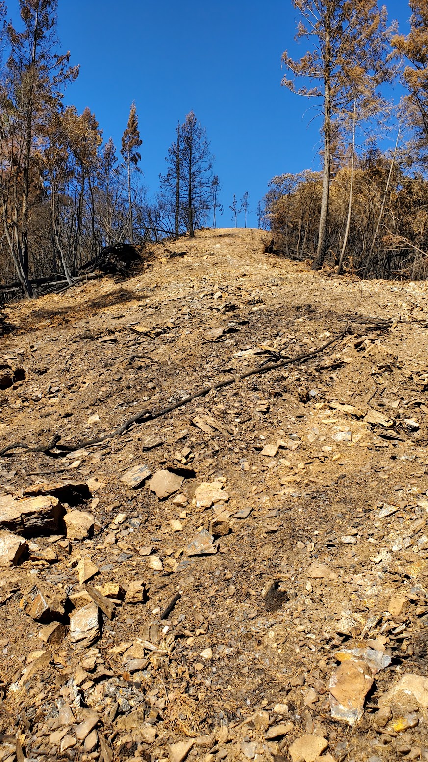
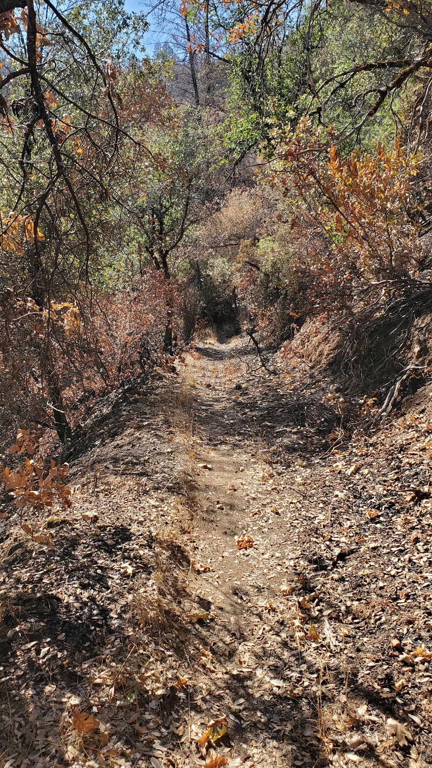
Some parts of the trail where the fire burned hot show much more damage to the vegetation while other parts show much less or little damage. In areas that burned hot, the vegetation holding soil in place was removed and as a result the soil will erode more quickly and undermine the stability root systems for trees causing them to fall. Areas where the fire did not burn as hot will be less prone to these negative effects, but will still experience significant soil erosion, tree mortality, and hazard trees. Mitigation of hazard trees and soil erosion that will occur when the winter rains start falling are the two big priorities.
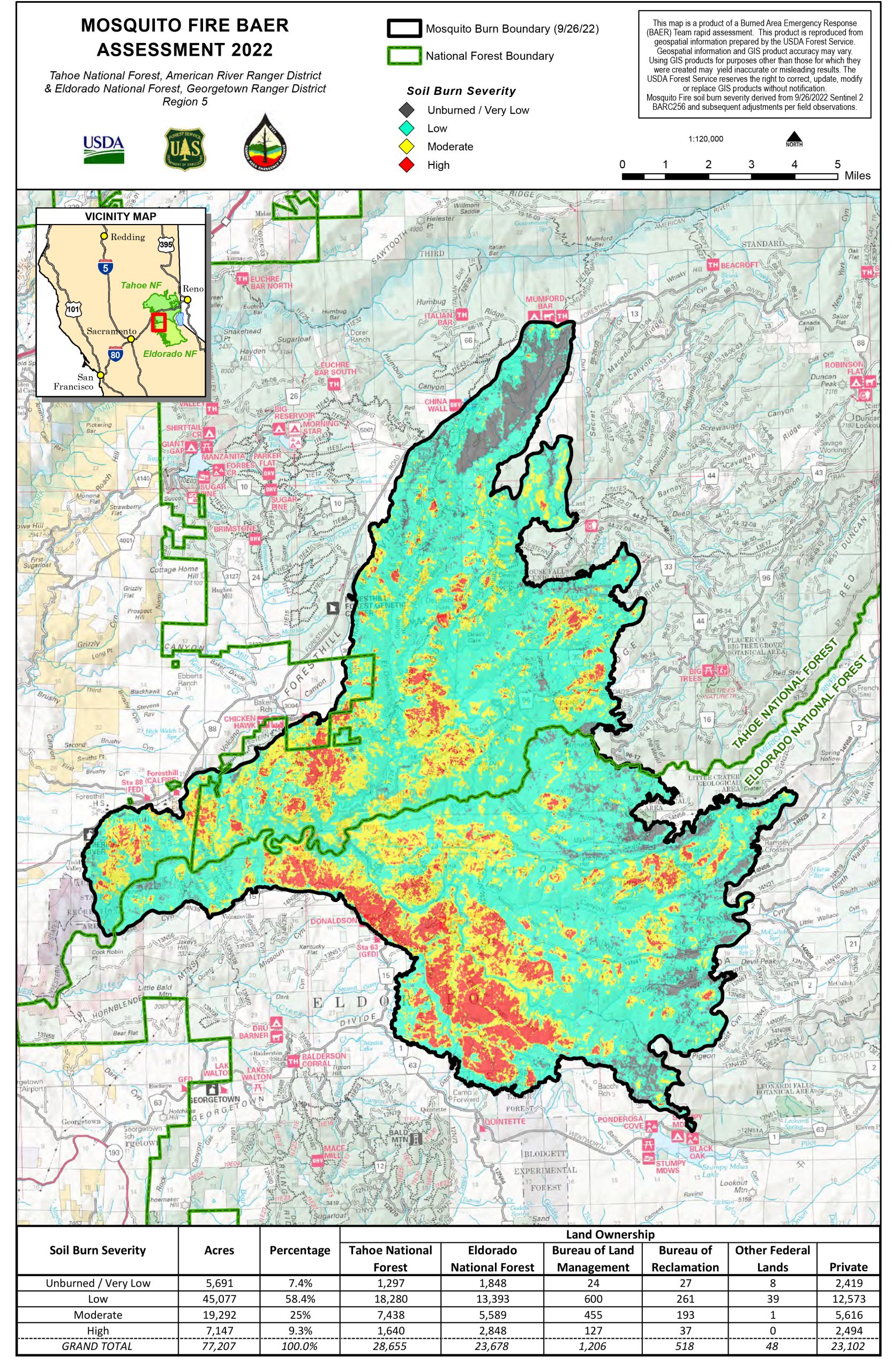
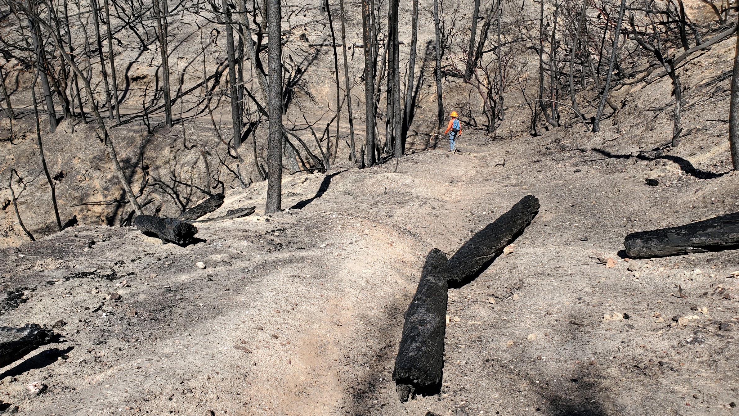
Damage repair from fire suppression activities has already begun (wide fire breaks are being either fully or if needed in the future partially restored, and water diversion features created). In addition some emergency stabilization activities (e.g., felling of hazard trees) has already begun. Emergency stabilization and long-term recovery and rehabilitation efforts will continue through the winter and spring, and may continue for up to 5 years. With respect to federal lands a Burned Area Emergency Response (BAER) Team has already been assembled, is performing a rapid assessment to determine the scope of the Emergency Stabilization that is required, estimate costs required to perform this work, and apply for BAER Funding. Additional funding for Long-Term Recovery and Burned Area Rehabilitation (BAR) may be available to assist in long-term recovery efforts. With regard to the State of California the Governors Office of Emergency Services (Cal OES) has been engaged, and provides a range of State Recovery Resources. In addition Placer County will help private land owners with removal of debris and hazardous materials, and removal of hazard trees.
This is not the first fire to impact the WS trail. The most recent fires were the Star Fire of 2001 and the American Fire of 2013.
The Western States Trail Foundation, Western States Endurance Run Foundation, and The Canyons Endurance Runs will be working with the agencies and owners to get the trail ready for our events in 2023. Trail work days are still TBD. We will share the info when it is created.
Tahoe National Forest, American River Ranger District lands are closed to the public until December 31, 2022, so there is no recreational trail access. ASRA has closed the fire affected area, from the Patent Road Fire Break east to Foresthill, until further notice.
For more info on the fire see: https://inciweb.nwcg.gov/incident/8398/
Discover more from WSER
Subscribe to get the latest posts sent to your email.