John Catts, WSER and Tevis Trail Manager
In September of 2022 the Mosquito Fire burned 16 miles of the Western States Trail. Some areas burned extremely hot and in these areas there was very little organic matter left on the ground. Other areas did not burn as hot or burned in a mosaic pattern with some areas minimally affected.
Before the fire was fully out, and continuing until early snow prevented further access, our partners with the U.S. Forest Service (USFS) and Auburn State Recreation Area (ASRA), as well as CalFire, traversed the affected stretches of the Western States Trail and felled hazard trees. After the hazard trees were felled and bucked (cut into smaller sections and removed from the trail), our attention turned to erosion control and tread repair. With little to no organic matter left in the upper soil horizon erosion occurs at a much faster rate, particularly when large rainfall events (like this winter) occur. As a result the main drainages and many previously insignificant drainages carried large amounts of water, rock, and soil downhill onto the trail, and in some locations erosion in some drainages undermined the trail.
In spite of weather-related constraints, we have made significant progress repairing damages caused by both the Mosquito Fire and once in a decade storms. Below is a summary of progress made to the trail on lands managed by ASRA and the USFS, as well as a description of a more complicated type of project (tread armoring), performed for several drainages in Eldorado Canyon (USFS).
Auburn State Recreation Area
ASRA has a sizable and qualified trail team that maintains its trails. Before the fire ASRA was committed to spending time and effort to re-bench the California Street Section of the Western States Trail this year. To assist in this effort ASRA enlisted the services of the California Conservation Corps (CCC, Auburn office). Re-benching, using a trail machine (and by hand where trail machine access is not possible), involves removal of adjacent vegetation, and re-contouring the trail tread by removing sluff from the uphill side, removing any outboard berm, and creating a wide trail tread that has a 5% outboard slope, so water will sheet flow onto and off the trail and not down the trail. This allows us to shift the footprint of the trail created by years of use to the middle of the bench, which is much safer for animals and people. ASRA started this process with the CCC Crew and have been moving from Rucky Chucky towards Ford Bar, have taken a break due to weather, but will be back working eastward on May 3rd.
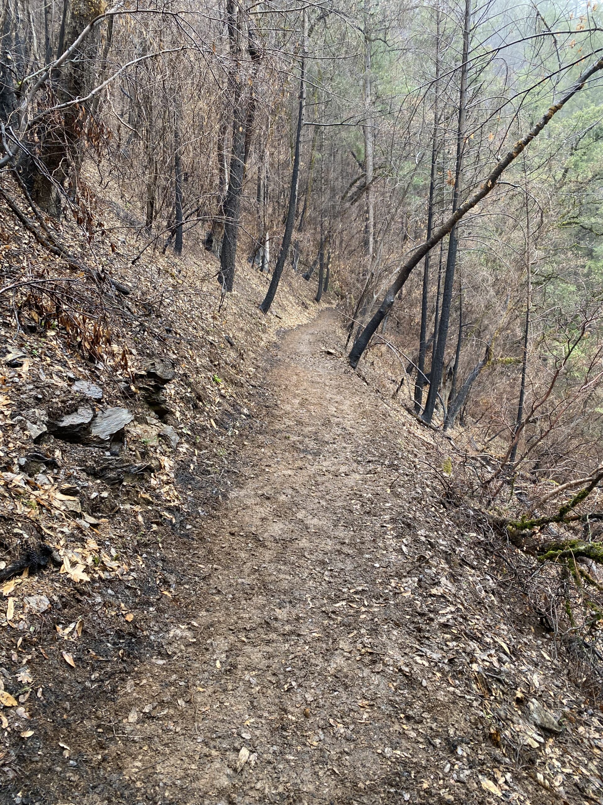
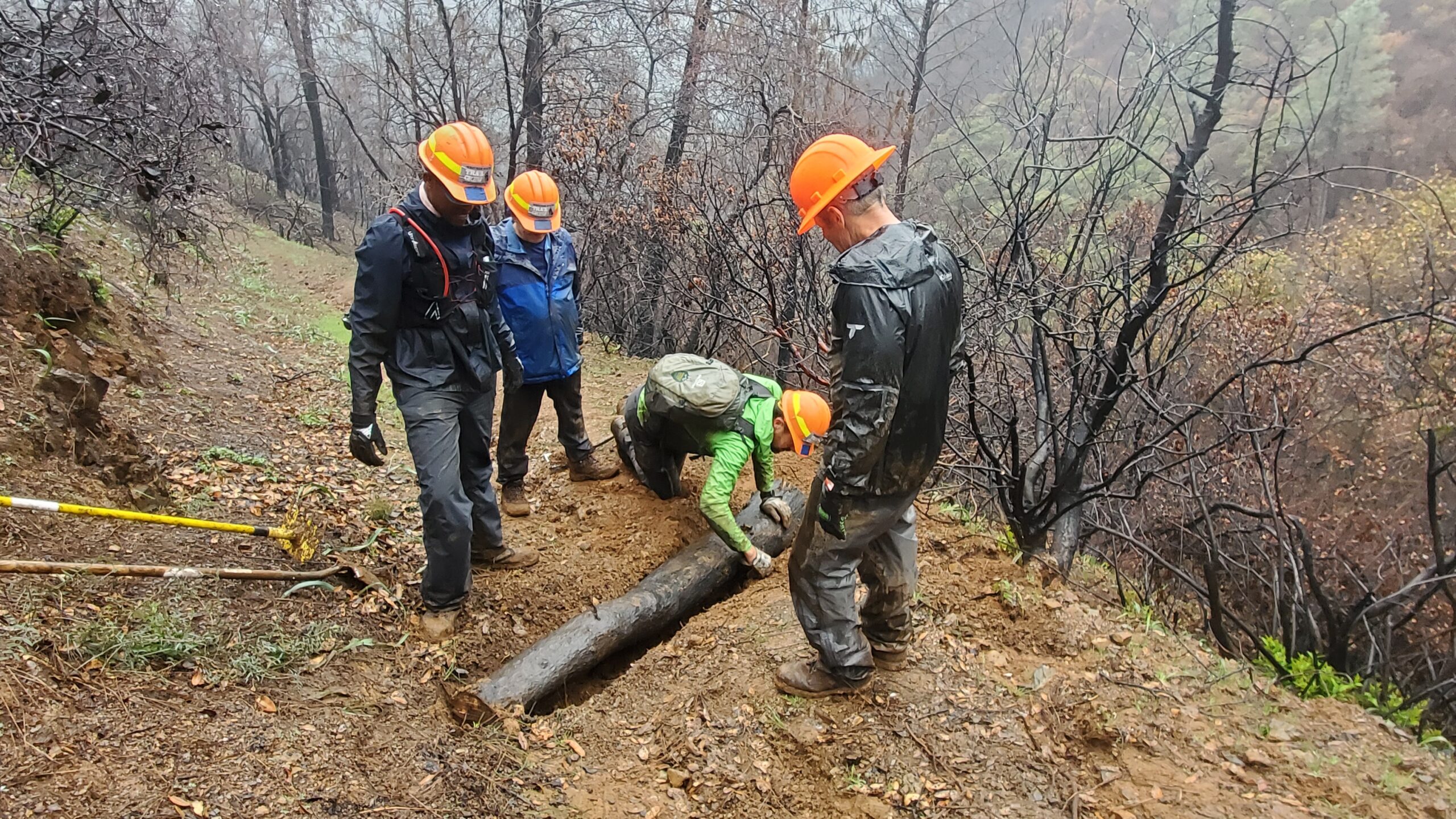
Meanwhile, on the 3.5 miles of the Western States Trail that burned in the Mosquito Fire (Dardanelles Creek to Patent Road Fire Break), our Trail Team spent the past 2 weekends repairing fire and storm damage. We cut what little vegetation remained within the trail corridor, removed eroded soil and rock from the trail tread, and to the extent possible with hand tools re-benched the trail. We also added erosion control features (waterbars) and repaired a few drainages. Photo #A is a completed stretch of trail, and Photo #B shows installation of a waterbar. Although the 3.5 miles of trail in ASRA that was burned in the Mosquito Fire is clear from obstructions and offers safe passage, there are still a few projects we need to complete, and the trail is still closed between Patent Road Fire Break and Dardanelles Creek.
Tahoe National Forest, American River Ranger District
As containment of the Mosquito Fire reached 100% the USFS was busy felling hazard trees in Eldorado Canyon and along Deadwood Ridge, which in most places burned very hot. The American River Ranger District Trail Team relied on federal Burned Area Emergency Restoration (BAER) funds to continue working in Eldorado Canyon through the fall and winter as weather permitted. Significant progress had been made restoring the trail in Eldorado Canyon. Activities include installation of erosional controls (mostly water bars), removal of eroded soil and rock from the trail, removal of large stumps from the trail corridor from hazard tree felling or other fallen trees, repair of historic retaining walls, and repair of the trail at drainages.
With funding from WSER & Tevis, a trail team from Sierra Buttes Trail Stewardship (SBTS) joined the USFS Trail Team to help with this effort. SBTS spent much of February in Eldorado Canyon, left when the weather was unsuitable, but will be back in late March or early April. The WSER & Tevis Trail Team, provided assistance on volunteer days in December 2022 and January 2023, and plan to get back into Eldorado Canyon in April. As the snow melts and access via Deadwood Road is available SBTS and our volunteer team will move east to Deadwood Ridge, and down to Swinging Bridge (the eastern extent of the burn on the Western States Trail). From there it’s business as usual to clear the remainder of the trail prior to our events (OK, there might be a bit more work this year with the deep snowpack).
Come join us on volunteer work days in April, May (to be posted soon) and June (https://www.wser.org/volunteering/trail-stewardship/).
A reminder that the Western States Trail from Michigan Bluff to Last Chance is still closed, as is Mosquito Ridge Road.
Tread Armoring Project
Many of the techniques we used to control erosion are visible to the trail user (log water bars, rock water bars, waddle, swales), but some methods used to control erosion and restore the trail tread are not immediately obvious to the trail user. Therefore, we thought it would be informative to describe, and show through photographs, a more complicated and labor-intensive type of trail project, tread armoring.
In drainages where erosion has caused the trail tread to be narrowed and weakened the potential repairs include construction of retaining walls or tread armoring. In Eldorado Canyon re-routing a trail is not an option, because side slopes are often extremely steep, and the historical designation of the trail prevents re-routing without extensive studies and analysis. On the east side of Eldorado Canyon several of the badly eroded drainages had ample large rock available, and tread armoring was the preferred restoration technique.
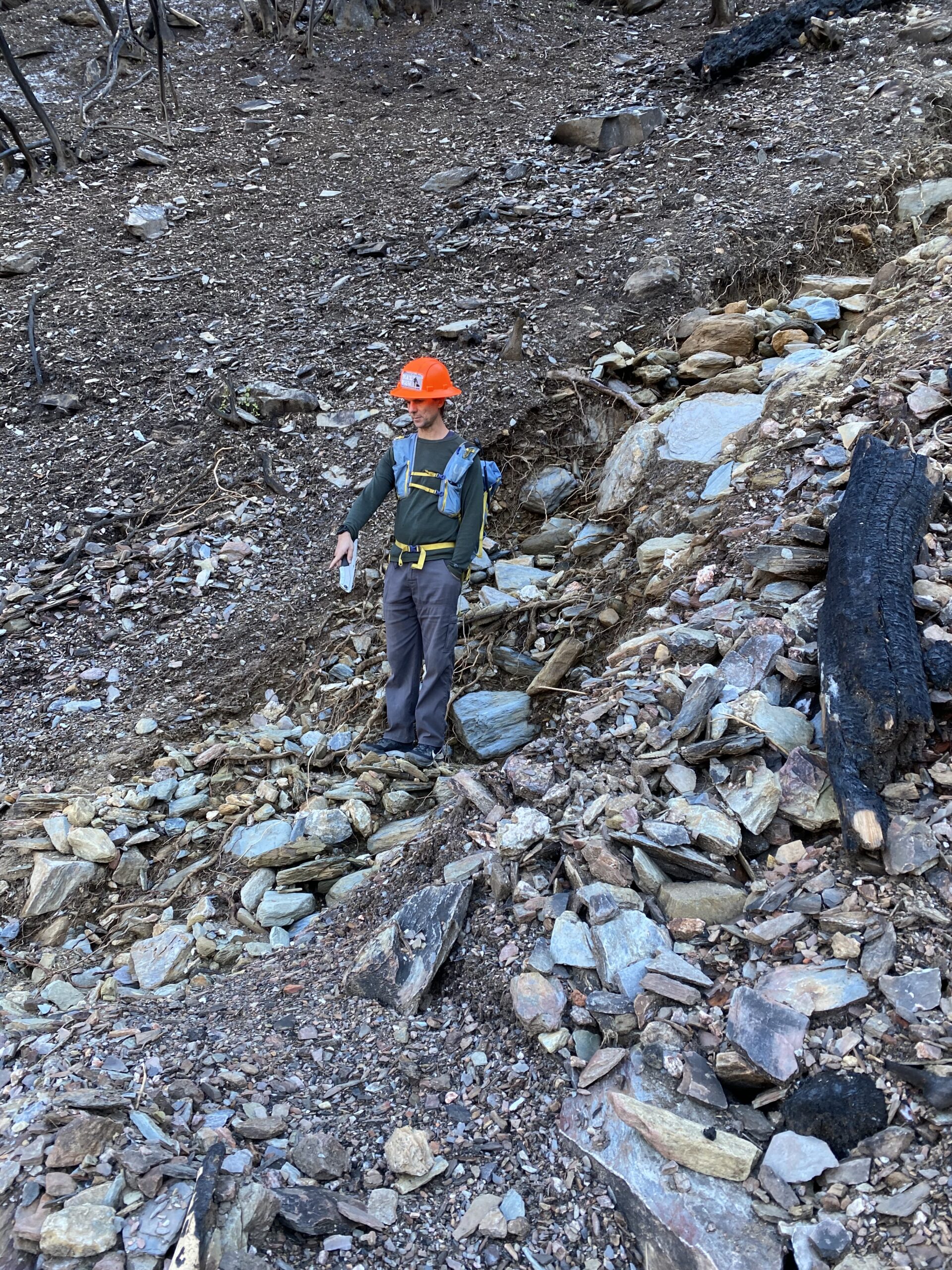
Photo #1 shows the condition of a drainage before the project was started. Note the quantity of rock that had been transported down the barren slope.
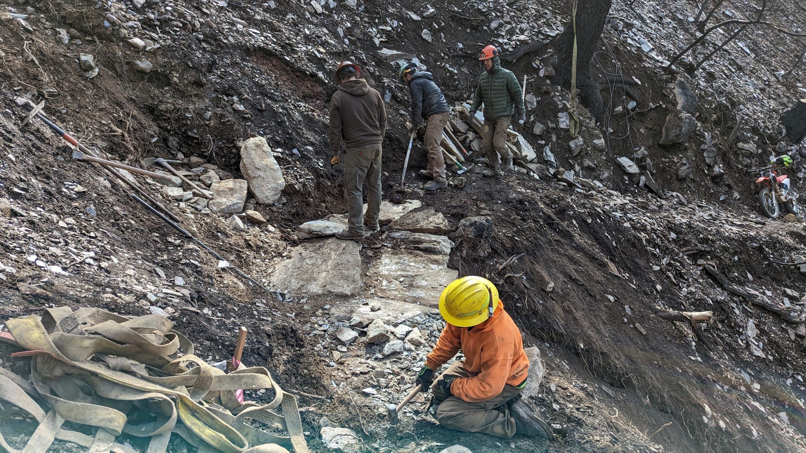
Photo #2 depicts the same drainage, from the opposite side, following removal of debris from the trail tread. Note the deeply incised drainage above & below the trail and narrowed and unstable trail tread.
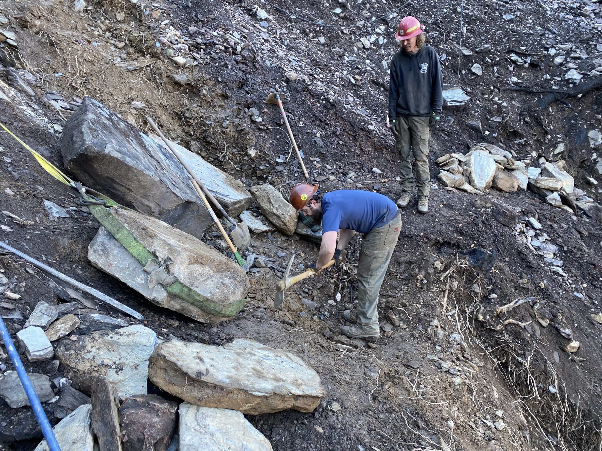
The next steps in the repair are to quarry suitable rock and excavate the trail tread to provide a stable base on which quarried rock will be placed. Large rocks of uniform thickness with flat surfaces are located and are transported to the site using rock slings, or if the rock is above or below the repair site lowered by hand or a grip hoist with a sling and moved with rock bars (Photo #3) or lifted up onto the trail with a grip hoist and rock bars.
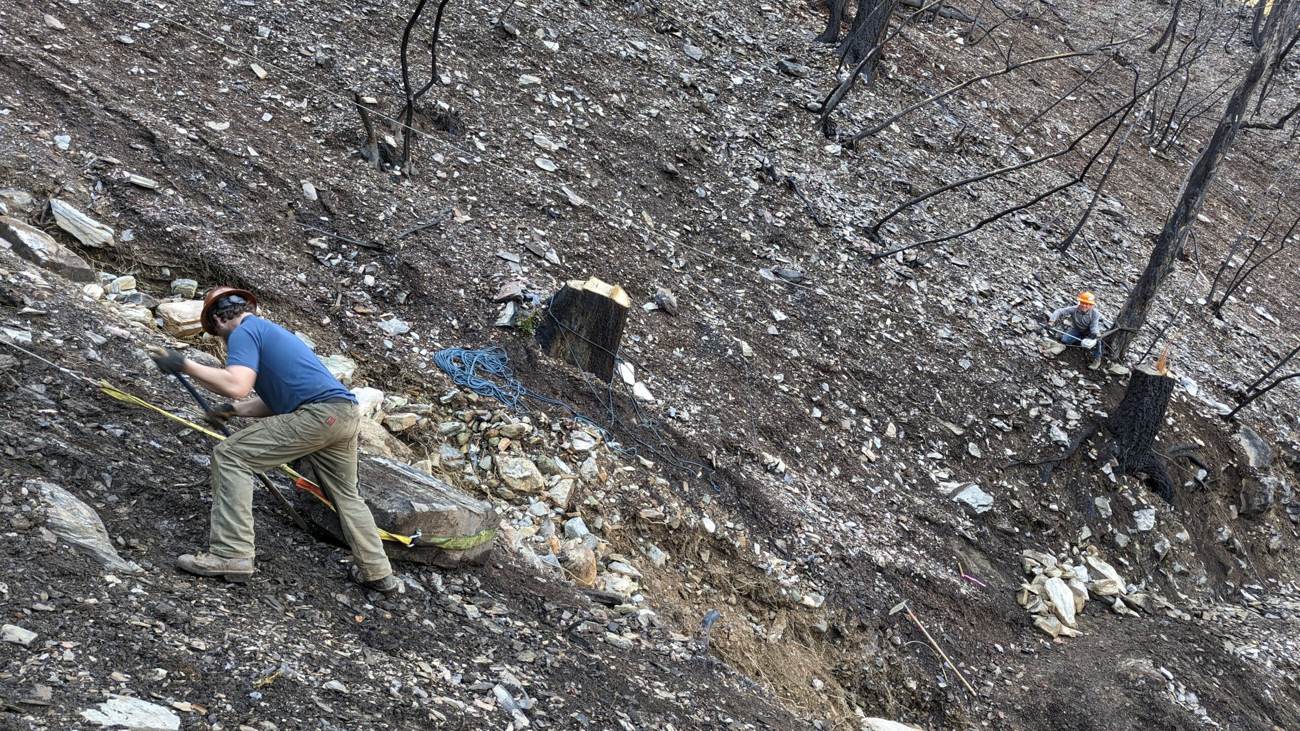
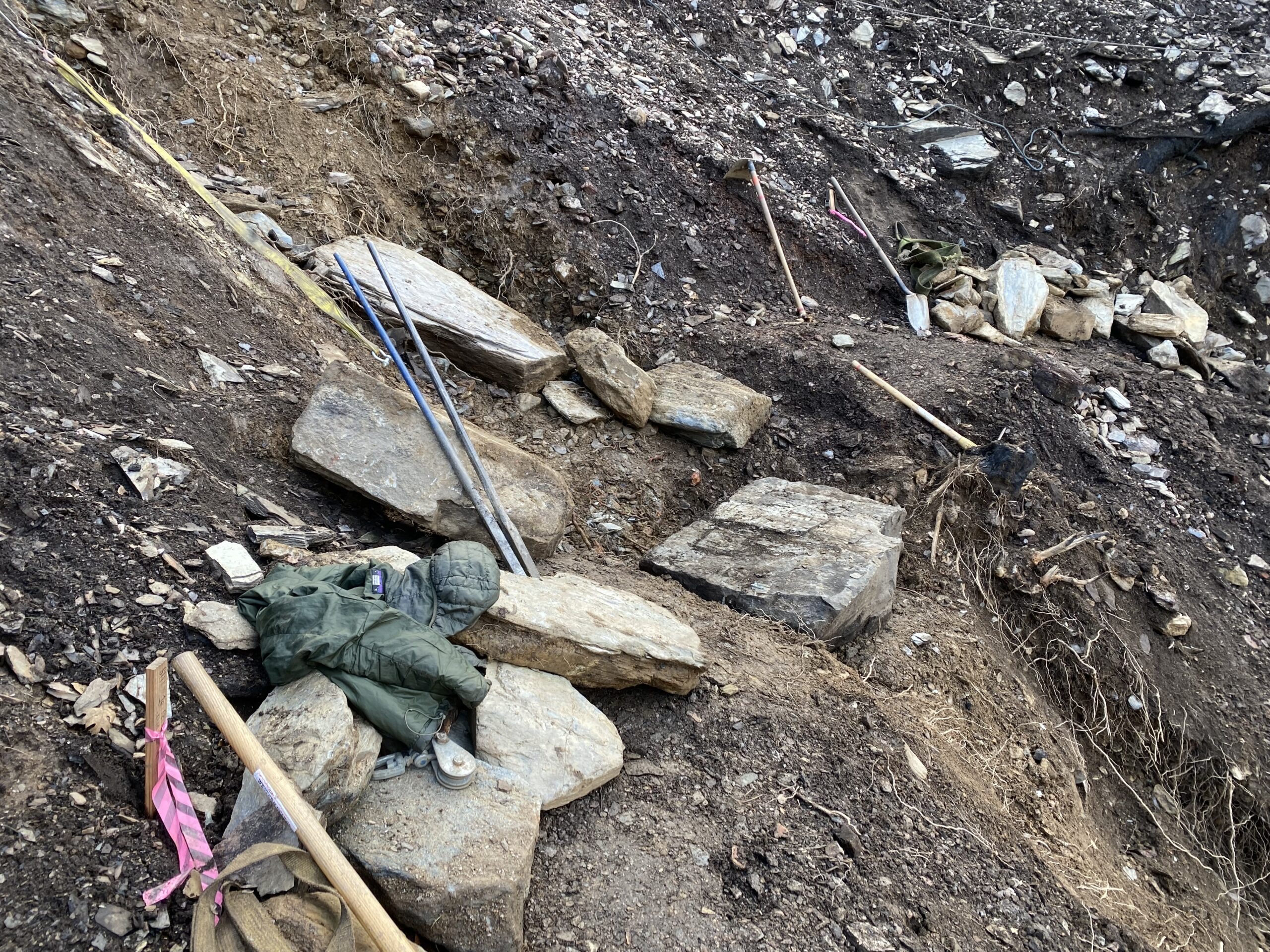
Photo #4 shows the excavation of the trail tread to create a stable base for the placement of quarried rock. Since the downhill edge of the trail tread in the drainage was eroded and undermined, we excavated into the uphill side of the drainage, creating a gentle curve to the trail alignment, to make adequate room for the required tread width.
Finding the best large rock, to be placed on the outboard side in the middle of the drainage, is key (Photo #5). Within the trail teams there are often calls for “get a bigger rock”. When set, this stone needs to be stable or the underlying soil needs to be further removed to be stable, without the use of shims (so it stays stable over time). Other rocks will be placed carefully next to this keystone to lock into this main rock and each needs to be adjusted to be stable by turning, flipping, or selectively removing soil beneath it until it is stable. Photo #6 shows the final placement of these large rocks at this specific site. It also shows that to create long lasting stability and prevent erosion, the space between all these rocks was filled with crush (smaller pieces of rock created by breaking up shaley rock with a small sledge hammer).
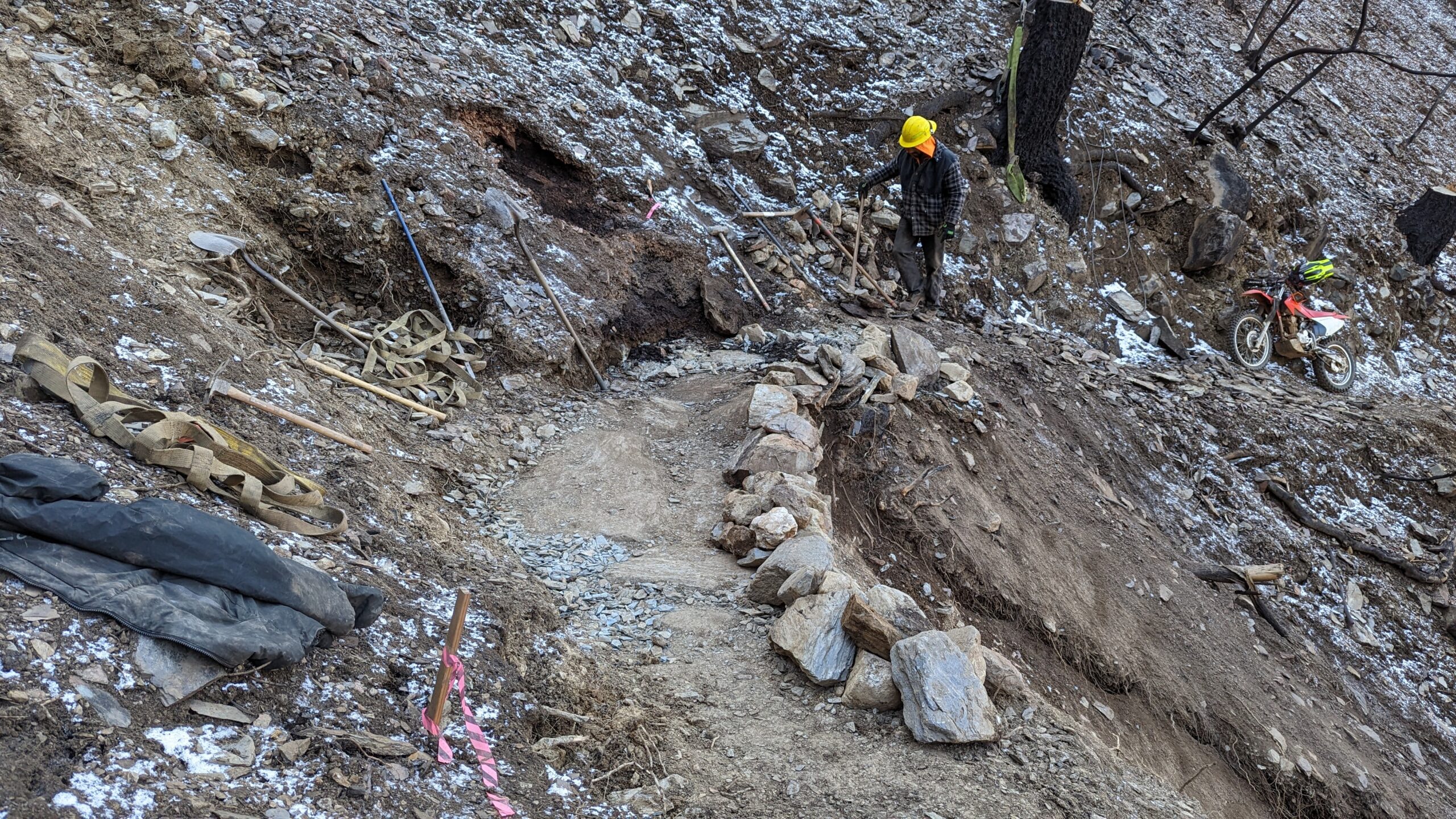
When all the interstitial space between rocks has been filled with crush, soil can be placed on top. For longevity and safety its best to either place large rock on the outboard edge to keep users off the outboard edge, and if possible outboard barrier rock can be set deeply into the outboard edge of the tread. Photo #7 shows the armoring repair nearing completion.
With the trail armored where a drainage crosses, any new material eroded onto the trail is easily removed.
So the next time you see a stretch of trail that looks like this, know there is a solid base beneath your feet (or your horses feet or wheels) and that a lot of work went into it.
Discover more from WSER
Subscribe to get the latest posts sent to your email.